
Run a Marshall County Property Search
Start with whatever detail you already hold. In Marshall County, open the WV Real Estate Assessment Property Search and set County to Marshall. Street Name works when the house number is unclear. Owner Name works for a person or entity. Full Parcel ID is best when an older record supplies the key. District narrows a street that crosses local lines.
Once a result opens, save the Full Parcel ID, Owner Name, situs, mailing address, map number, parcel, sub-parcel, deed book and page, and legal description. Those identifiers carry into the County Clerk index and the tax and GIS records. These are the join keys for everything that follows. Never copy just a screen title. A name may repeat, a road may cross districts, and one town name may cover more than one land-book group.
- Search Marshall County by Street Name, Owner Name, or Full Parcel ID.
- Open each plausible row and compare district, situs, and legal description.
- Keep the deed book/page and parcel identifiers in the same note.
- Check sale history and prior ownership, then confirm the latest recorded deed.
- Use the map viewer to see where the parcel sits, not to settle a boundary.
Search Marshall County Streets and Blocks
The Street Name field covers situs streets only. It can return several rows at once. That helps when a property lacks a visible number, when a road has been renumbered, or when the goal is the lots beside a known address. Results may also span a road segment or a municipal edge. Check the district and map numbers first.
Try a short name first. Review the whole row list before adding a district. If a Moundsville street gives odd results, the Clerk's town-lot system separates "Moundsville in Clay" from "Moundsville in Washington." The tax district matters. Record it with the street and owner so the same parcel can be found again. A street search is not a census of residents.
Results list assessment parcels and owner-of-record names. For true adjacency, compare the parcels in GIS and lean on the plat or deed where a boundary matters. The street search itself will not settle a boundary question.
Marshall County Search Field Inventory
The state search offers Basic, Appraisal/Sales, Advanced, and Prior Ownership areas. Every field is optional. The portal controls the dropdown choices. This table reflects the field labels documented for Marshall County, so a current screen may revise labels or option lists; use the live form for the final input format.
| Field group | Fields and use |
|---|---|
| Place and owner | County, District, Owner Name, Street Name, Mailing Address |
| Parcel keys | Full Parcel ID, Map Number, Parcel, Sub-Parcel, Tax Class, Property Class, Land Use |
| Appraisal ranges | Min/Max Land Appr, Building Appr, Total Appr, Calculated Acres, Deeded Acres |
| Sale history | Sale From/Through, Min/Max Price |
| Advanced details | Flood Hazard, Deed Book, Page, Legal Description |
| Improvements | Building Year, Primary Structures, Secondary Structures, Building Area ranges |
| Output | Lines per page, display legal description, display GIS parcel ID, Search and Reset controls |
A result can expose owner and mailing details, physical address, tax class, land use, land, building, and total appraisal, acreage, reported sale date and price, deed reference, legal description, building year and area, structure counts, and prior ownership when selected. Treat the parcel ID as the durable join key. A name alone will not hold up across systems.
See the WV property assessment search for Marshall County. The same form drives every Marshall County query. Its form image shows the county, district, owner, street, parcel, sales, and building categories in use.
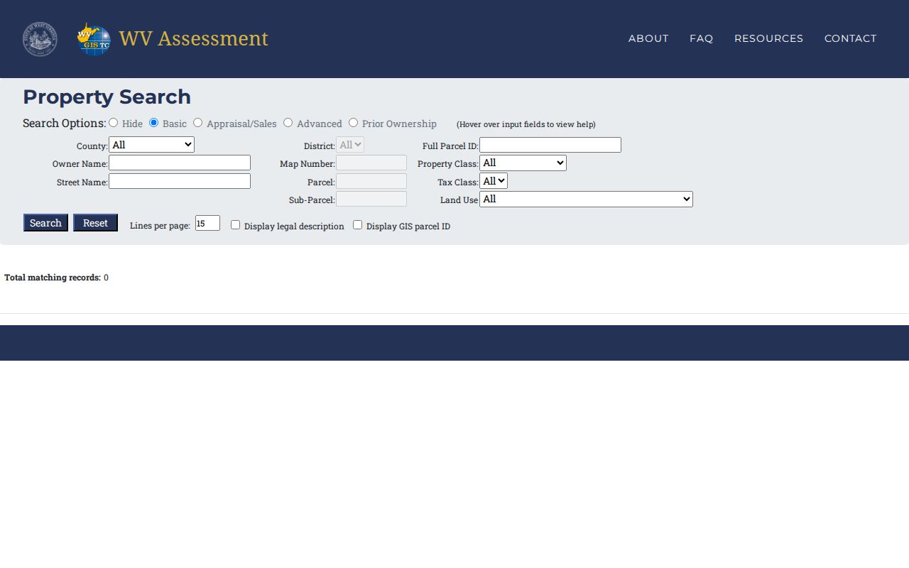
Copy the values and the date viewed. A later roll update can then be told apart from a change in title.
Marshall County Address, Owner, or Parcel
Address, owner name, and parcel number answer different questions. An address points to a physical location. An owner name can pull up several parcels. A parcel number targets a single assessment unit, though a split, merge, or new subdivision can force a revised identifier. Run the key that matches your question, then cross-check the other fields in the result.
| Starting key | Best use | Marshall County caution |
|---|---|---|
| Street Name | Locate a site or list parcels along a road | Multiple districts or nearby cities may appear |
| Owner Name | Find parcels tied to a person or entity | Try initials, spelling variants, LLC, trust, or estate names |
| Full Parcel ID | Match a specific assessment record | Retain district, map, parcel, and sub-parcel parts |
The WV portal splits identifiers into County, District, Full Parcel ID, Map Number, Parcel, and Sub-Parcel. No single text pattern fits every Marshall parcel. Never add or strip leading zeros on a guess. Copy the exact display instead. Ask the Assessor about re-parceling whenever the legal description points to a different number.
Owner Name, Situs, and Mailing
Owner Name is the assessment roll's current owner-of-record field. Situs is the physical location being assessed. Mailing Address is where the tax notice goes. A family trust may own a Marshall County parcel while its notices go to a trustee or agent in another state. An LLC name may differ from the sign on the building. None of those differences alone proves a row is wrong.
Compare each field against the recorded deed and the latest tax ticket. If an address search fails, try the road name without the number, a former street spelling, the owner's exact form, or the legal description. When the mailing city seems to clash with the property location, keep the district and parcel identifiers. West Virginia ZIP patterns do not set incorporated limits or tax districts.
Take name or map-card corrections to the Assessor. The County Clerk handles errors in a recorded instrument. Fixing one system does not fix them all.
Sale Filters and Marshall County Appraisal
Sale and appraisal filters narrow a Marshall County search by land, building, and total appraisal. Calculated and deeded acres work too. So do sale date and sale price. Ranges are best for building a comparison set of Marshall County property records. They are not for pegging an offer to a single hit. West Virginia assesses property at 60% of fair market value. That assessment falls on the July 1 date. Exemptions change the tax bill. They do not turn the record into a sale appraisal.
A deed reports consideration and other transfer details. The Assessor's appraisal fields and sale history answer different questions on different update cycles. Expect the two figures to disagree. State rules send parcel visits out on a three-year cycle. Annual adjustments follow when changes surface. A recent sale is good evidence. It is no promise the tax roll updates at once. Save exact sale-date windows for searches that truly need them. A tight price range can hide a transfer whose consideration was never booked as a plain sale price.
Moundsville’s Two Town-Lot Districts
Moundsville results hide a county-specific trap. Town lots sit under Clay suffix 10 and Washington suffix 11. Those numbers belong to the County Clerk's town-lot image search. They are not part of any universal parcel-number formula. Start with the Assessor's district and legal description. Then choose Town Lots or Tract Land. Enter the book year plus the matching two-digit suffix, and page through the images.
The IDX path offers an Image Search ribbon. It splits into two land-book sets, one for Town Lots and one for Tract Land. Its public page text does not lay out a party-name, document-type, or earliest-year range. A failed name search is not final. Try the alternate Moundsville district. Try the legal description, a former owner, and the right land-book type. Open the Marshall County map-card viewer whenever the district or land class is unclear. The card carries tax-map context forward into the Clerk's suffix search.
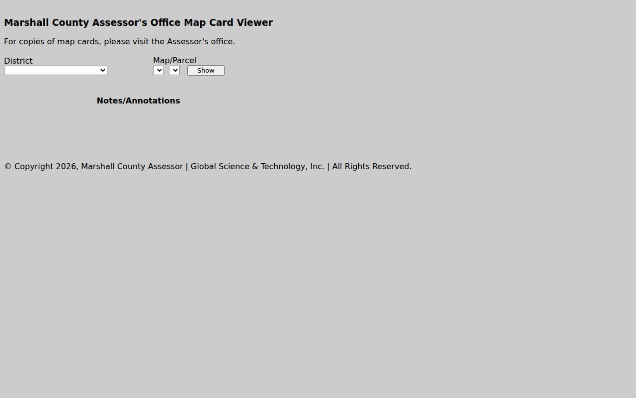
For a boundary or subdivision name, compare the map card against the recorded plat. The card is not a survey.
Prior Ownership as a Marshall County Lead
The assessment portal includes a Prior Ownership area. Selecting it can reveal earlier ownership on a result. Treat it as a fast lead toward the next deed, not a substitute for the County Clerk's recorded index. Search the current owner as grantee, then run the deed's grantor name as your next prior-owner search. Confirm the legal description at every step.
Marshall County's online instructions do not state the oldest grantor-grantee year. They also skip a full deed search-field inventory. When a prior record stops, ask three questions. Is the land-book year scanned? Is the instrument indexed under a different party form, and is a deed book waiting at the counter? A missing result never proves the title began there.
What a Marshall County Result Shows
Marshall County results can include owner, tax class, land use, acreage, parcel identifiers, and physical and mailing addresses. Separate land and building appraisals appear too. So do sale date and price, deed book and page, legal description, building year and area, structure counts, and prior ownership. Display options add the legal description and GIS parcel ID. That is a rich result. Still, note the limits. A tax card is not a title opinion. The assessor may lag a newly recorded deed, and a GIS polygon is no licensed survey. Before a purchase, dispute, or estate filing, use the matching deed, court or probate papers, plat, and tax account. The assessment page starts the parcel. The custodian confirms the underlying file.
Marshall County Search Gaps and Next Steps
New parcel lines can lag the statewide viewer for years after the county submits a change. A recent split may reach an assessor record first. Its map shape shows up later. Save the Full Parcel ID, legal description, map scale, and book/page reference before you call anyone. Then ask the Assessor for the current card. Or ask the Clerk for the recorded deed or plat. Courthouse computers handle tax and index searches. The County Clerk allows viewing of scanned books, though account and checkout steps gate downloading and printing. Copies cost $1.50 for the first two pages and $1 for each additional page. Call 304-845-1220 first. The county announced a temporary office move in 2026.
A precise request names the parcel, instrument type, approximate date, and whether an image or certified copy is needed. Route tax status to the Sheriff's Tax Division, assessment corrections to the Assessor, and deed questions to the Clerk.
Marshall County Search Is Not Title
A Marshall County property search links public facts fast. It does not certify ownership. It settles no boundary, nor guarantees every interest was recorded or digitized. Locate the parcel on the assessment roll, confirm the transfer with the recorded deed, and bring in a qualified title professional or surveyor when legal certainty matters.
Not a title search. Use owner and parcel information for lawful property research, purchase diligence, tax review, and house history. Do not use public data to stalk, threaten, or harass anyone.